
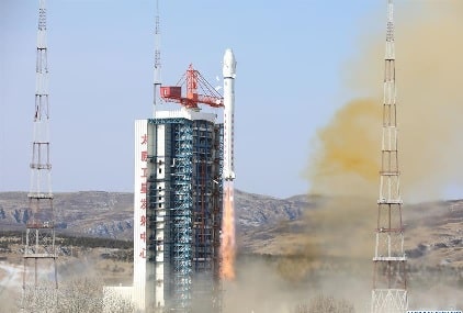
- The satellites of the PIESAT-1 constellation were launched at 6:50 p.m. (Beijing Time) from the Taiyuan Satellite Launch Center in northern China’s Shanxi Province, and then entered a preset orbit.
- WHEEL FORMATION
- The in-orbit constellation has formed a lineup like a vehicle wheel. It comprises a primary satellite running at the central “axle” and three supplementary satellites evenly placed in an elliptical “wheel hub” and orbiting the primary satellite. The supplementary trio is located just a few hundred meters from the primary satellite.
- The constellation is capable of maintaining its stability and space safety, thanks to precise orbital control supported by inter-satellite links and phase synchronization links.
- The four satellites are equipped with interferometric synthetic aperture radars (InSARs), which are effective tools to measure changes in land surface.
- The InSARs capture two images at different times by reflecting radar signals off a target area on Earth, and then have them interfere with each other to produce maps called interferograms, which reveal the ground-surface displacement between the two time periods.
- Unlike visible or infrared light, radar waves can penetrate most weather clouds and are equally effective in darkness.
- DISASTER PREVENTION
- Compared to traditional InSARs, a wheel formation can generate more interference baselines, thus increasing mapping efficiency.
- The constellation, mainly used to provide commercial remote-sensing data services, is capable of conducting rapid high-efficiency global land surveys.
- It can realize millimeter-level deformation monitoring to identify land subsidence, surface collapses and landslides, meaning it is an effective weapon for the early detection of major geological disasters.
- The constellation has the full-time, all-weather ability to take high-quality, submeter-scale, broad-width images of our planet.
- It was designed by the satellite maker Galaxy Space (Beijing) Network Technology, and it will be used by PIESAT, a satellite operation and application services provider in China.
- The Long March-2D carrier rocket is a two-stage launch vehicle with a take-off thrust of 300 tonnes, and it is capable of lifting 1.3-tonne payloads to the solar synchronous circular orbit 700 km above Earth.

This mission was the 469th flight of the Long March carrier rockets.